The United States is on alert for the first tropical storm of the season as a powerful cyclone spawns in the Gulf of Mexico.
National weather services have issued advisories for the ‘disturbance’ which could over the coming days explode into ‘Tropical Storm Alberto’.
Surging heat from the south and moisture from the ocean is fuelling the growth of the pre-hurricane storm which would be the first of the 2024 season.
Whether or not it matures, the deep low-pressure system threatens torrential downpours and flooding across southern states.
Weather Channel meteorologist Danielle Banks said: “There is a chance of seeing this become a tropical storm possibly Wednesday.
“Impacts will include heavy rainfall for large regions of central America, north-eastern Mexico and also, south Texas.
“Impacts are going to arrive well ahead of landfall, and the expected rainfall totals could be anywhere between three and eight inches, although localised higher totals are not out of the question.”
High surf tides and rip currents will form in the storm’s path, she warned, with the western Gulf coast most at risk.
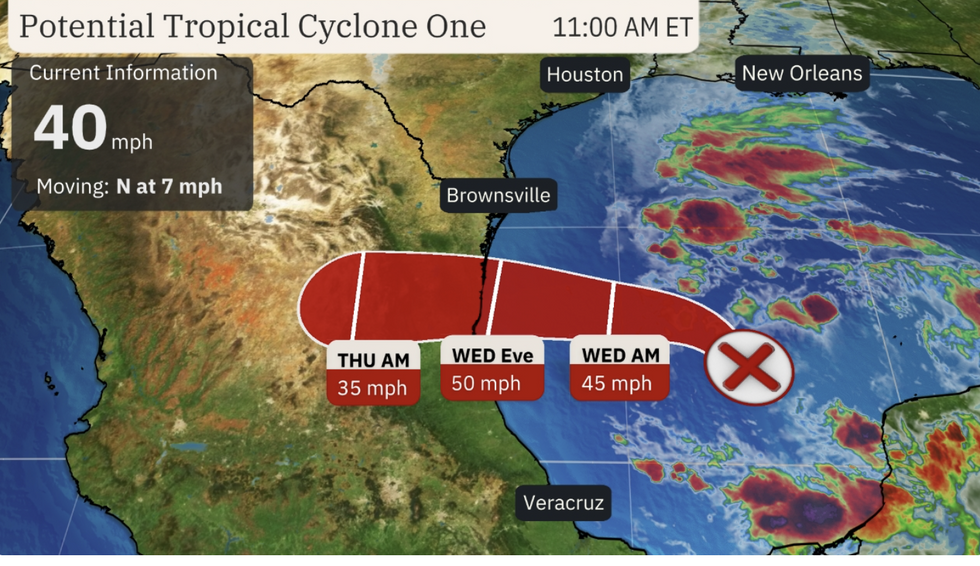
The storm, currently a ‘tropical disturbance’ pre-cursor to a possible tropical storm, has been dubbed ‘Potential Tropical Cyclone One’ by America’s National Hurricane Centre (NHC).
LATEST DEVELOPMENTS:

Potential ’Tropical Storm Alberto’ forms off the US coast
The Weather Channel
It is forecast to strengthen over the next 24 hours before moving into eastern Mexico and Texas.
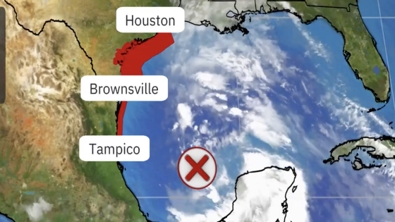
Tropical storm warnings are in force across the Texas coast with more than 10 inches of rain possible in parts.
Weather Channel spokesman Chris DeWeese said: “Tropical storm warnings and watches have been issued for Texas and Mexico ahead of a disturbance in the southwest Gulf of Mexico that the National Hurricane Centre has designated Potential Tropical Cyclone One.
“If the system strengthens to a tropical storm, it will earn the first name in the 2024 Atlantic hurricane season list, and this will be Alberto.
“Now is the time to prepare in areas including portions of the Texas coast where tropical storm conditions are expected to begin on Wednesday.”
A two- to four-foot storm surge threatens flooding along the Texas coast in the Galveston Bay region.
Easterly winds to the north of the storm will thrust a massive sea swell towards the US coast, experts warn.
The US National Weather Service (NOAA) has a ‘Tropical Storm Warning’ in force across southern Texas.
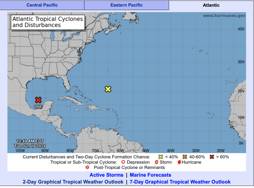
A spokesman said: “The National Hurricane Centre has initiated advisories on Potential Tropical Cyclone One in the Gulf of Mexico.
“This could result in locally heavy rainfall in excess of 10 inches near or just inland of the lower to middle Texas coast, and this would result in significant flash flooding.
“The heavy rain is forecast to push farther inland across the Rio Grande Valley early on Thursday.”

National Hurricane Centre names the disturbance ‘One’
Hurricanes.gov
Regions in the storm’s path are also on alert for damage from tropical storm-force-winds, NOAA said.
It comes as southern America bakes in a deadly heatwave that is sending temperatures past the 110F mark.
Away from the tropical disturbance, a plume of warm air and humidity from the Gulf of Mexico threatens to drive a separate spate of inland storms.
Jim Dale, US weather correspondent and meteorologist for British Weather Services, said: “The heat is the main story this week with very high temperatures as warm air comes up from the Gulf of Mexico.
“As this hits cooler air to the north, there is going to be a risk of storms, and some of these will be thundery with the threat of hail.”
Source Agencies


