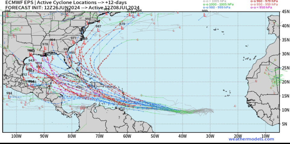
While nothing is imminent at the moment, the ECMWF ensemble tracks from 51 different versions of the ECMWF model indicate conditions will be favorable for tropical development in the next 12 days.
From the National Hurricane Center:
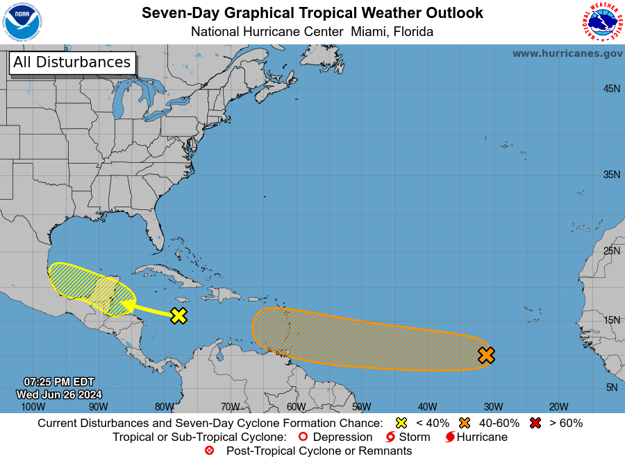
Eastern Tropical Atlantic (AL95):
Satellite images indicate that a tropical wave located several hundred miles southwest of the Cabo Verde Islands has become better organized since yesterday with a more concentrated area of thunderstorms. Environmental conditions are forecast to be unusually conducive for late June across the central and western tropical Atlantic, and further development of this system is anticipated. A tropical depression or tropical storm could form this weekend several hundred miles east of the Windward Islands while the system moves westward at 15 to 20 mph.
* Formation chance through 48 hours…low…30 percent.
* Formation chance through 7 days…medium…60 percent.
Copyright 2024 Nexstar Media, Inc. All rights reserved. This material may not be published, broadcast, rewritten, or redistributed.
For the latest news, weather, sports, and streaming video, head to WGN-TV.
Source Agencies


