Hurricane Beryl made the first U.S. landfall of the 2024 hurricane season along the coast in Matagorda, Texas around 4 a.m. as a Category 1 storm.
Beryl battered the coastal community between Corpus Christi and Galveston, according to the National Hurricane Center, with powerful and damaging winds of over 80 mph and extreme rainfall and flooding as over 1.3 million customers are already without power.
AccuWeather meteorologists expect life-threatening storm surge as high as 6-10 feet as tornado watches and warnings are in effect and expected to expand across the central states as it heads into the Greater Lakes region later this week.

Where has Hurricane Beryl been?
This was the third landfall for Hurricane Beryl in the past eight days.
Beryl made history as the earliest-forming Category 5 Atlantic hurricane. It began forming around June 28 and intensified rapidly as it moved through the warm Atlantic waters.
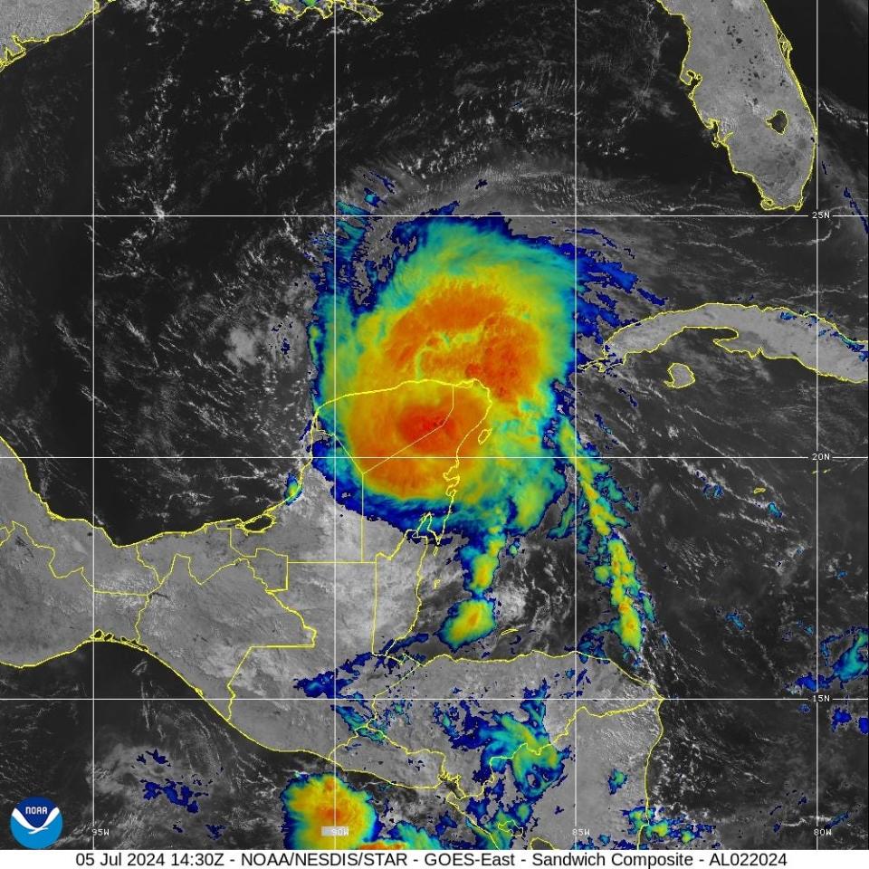
A week ago, on July 1, Beryl hit the Carriacou Island, Grenada as a Category 4 hurricane with 150 mph winds. By Friday, July 5, Beryl had weakened to a Category 2 storm and hit Tulum, Mexico with 110 mph winds.


Where is Hurricane Beryl headed next?
AccuWeather forecasts Beryl will continue to bring damaging winds, storm surge and flooding, with damaging wind gusts and tornados in the south-central parts of the United States, into Tuesday. But its impacts are expected to extend far beyond to the north and east, through the central United States, bringing heavy downpours and a continued risk for spawning twisters or tornados.
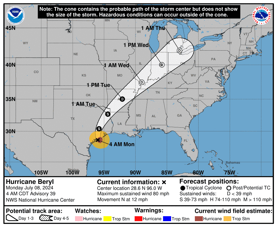
The forecast track has Beryl’s center over eastern Texas Monday, and then moving along through the Lower Mississippi Valley, into the Ohio Valley on Tuesday and Wednesday, and into the Great Lakes region by Thursday.
This article originally appeared on USATNetwork: Hurricane Beryl path tracker: Where it it headed next?
Source Agencies


