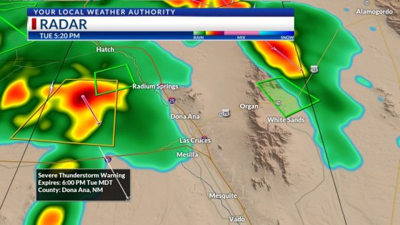

This severe storm in Dona Ana County is the perfect example of the potential for strong storms and heavy rain tonight. This storm has winds in excess of 60 mph and quarter size hail. Though this storm’s warning expires at 6 PM, we need to be prepared for similar storms in El Paso later.
TONIGHT: KTSM has issued a Weather Authority Alert due to the potential for strong storms and brief, heavy rainfall tonight and over the next two days. The skies will be partly cloudy with widely scattered showers and t-showers. Some storms may become strong and produce brief, heavy rainfall. Storms will slowly taper off before midnight. The low will drop to 73, and the SE winds will range from 5-15 mph with occasional gusts.
FORECAST: Wednesday will be partly to mostly cloudy with widely scattered late day t-showers. Wednesday’s high: 98. Again, some of the t-showers on Wednesday may become strong and produce brief, heavy rainfall. The SE winds will range from 5-15 mph with occasional gusts. Thursday will be partly cloudy with late day t-showers and a high of 97. Friday will be hot and dry with a high of 100. Saturday will be partly cloudy with a very slight chance of an isolated area t-storm and a high of 103. Sunday will be partly to mostly cloudy and cooler with a high of 93. Expect widely scattered showers and t-showers.

Copyright 2024 Nexstar Media, Inc. All rights reserved. This material may not be published, broadcast, rewritten, or redistributed.
For the latest news, weather, sports, and streaming video, head to KTSM 9 News.
Source Agencies