Blazing heat roasting the United States has swathes of the country parched to the point of ‘flash drought’.
Weeks of searing sun magnified under a rainless heat dome has turned miles of green pasture into desert dust bowls.
Temperatures show no sign of relenting as national weather authorities reinforce warnings for extreme heat and wildfires.
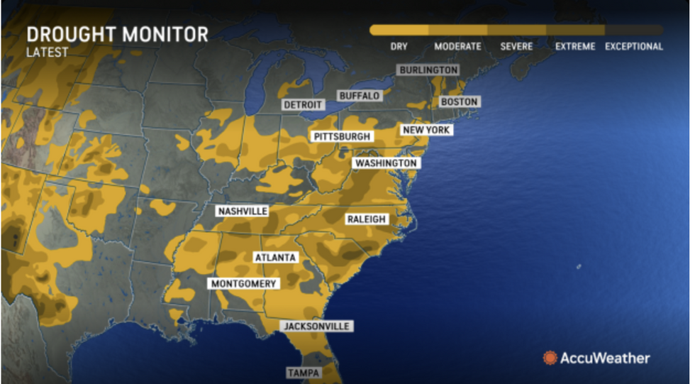
The US Drought Monitor, which logs the weekly drought status, reported a growing threat from mild-June when the ‘heat dome’ settled over America.
AccuWeather meteorologist Bernie Rayno said: “Following weeks of intense summer heat and little rainfall, a flash drought has developed and intensified in a region stretching from the Carolinas to Pennsylvania.
“The lack of rainfall combined with relentless, widespread heat have really dried this area out.
“The situation changed in mid-June when an area of high pressure parked itself over the Southeast and mid-Atlantic, creating a prolonged heat wave that sent temperatures soaring into the 90Fs.”
‘Flash drought’ describes a sudden and extreme onset of drought conditions which happen during periods of extreme neat and little rain.
They can dry the ground rapidly and have devastating effects on wildlife, gardens and crop production.
The current flash drought set in when temperatures rocketed during the start of summer.
LATEST DEVELOPMENTS:

The East Coast and the South could suffer drought conditions
AccuWeather
A huge region of high pressure currently shifting eastwards has prevented rain falling over stricken regions.
Overall, parts of the United States have seen less than 25 percent of the usual rainfall for June, according to AccuWeather expert.
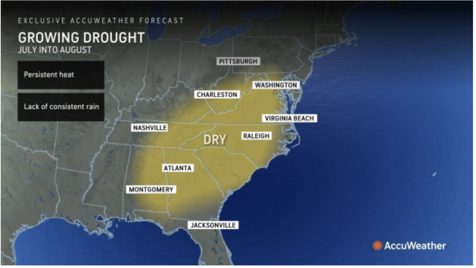
AccuWeather meteorologist Paul Pastelok said: “This area will be in search of assistance from the tropics in August to break the drought.
“If that does not come, the drought will hold the rest of the summer into the early fall, based on the forecast pattern.”
Fierce heat continues to bake the United States with the east and northeast this week in the firing line.
The National Weather Service (NOAA) has warnings in force in around 20 states with separate wildfire alerts covering the northwest.

A huge region of high pressure currently shifting eastwards has prevented rain falling over stricken regions
AccuWeather
Elsewhere, in regions outside the heat dome, tropical moisture from the south will trigger fierce thunderstorms.
A NOAA spokesman said: “On Thursday, as a front moves south-eastwards, showers and strong to severe thunderstorms will develop over parts of the southern Mid-Atlantic.
“A second area of showers and strong to severe thunderstorms will develop over parts of the Central/Southern High Plains as moisture interacts with upper-level impulses.
“Extremely dangerous and potentially deadly heat, particularly for urban areas in the Southeast and East Coast, are forecast, and many daily record highs are possible for the East Coast, while numerous warm overnight lows will provide little relief from the heat.”
Jim Dale, meteorologist for British Weather Services and co-author of ‘Surviving Extreme Weather’, said: “Extreme heat is going to remain the main concern for many states, although with that will be the continual risk of storms around the peripheries where hot air meets cooler air creating unstable atmospheric conditions.
“With the lack of rain, this will bring the added risk of wildfires.”
Source Agencies


