A tropical disturbance in the Atlantic is getting better organized.
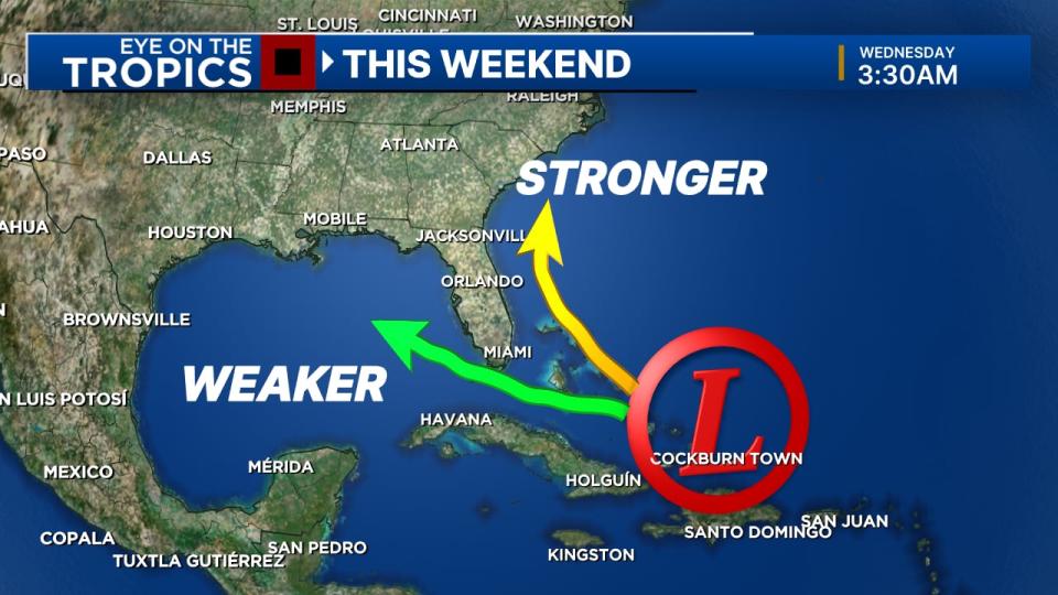
Forecast models show the system will be just offshore of us, in the Bahamas, on Saturday.
The system shows a 60% chance of developing into a named storm over the weekend.
Read: FWC, U.S. Fish and Wildlife Service form plan to help “confused” sea turtles in Flagler County
Most indications keep this area offshore of Florida and then swing it up toward the Carolinas.
Either way, the chance of rain should increase on Sunday and Monday.
Since it is still developing, the overall track remains uncertain.

There are a few major models that also keep the system south of Florida and moving into the Gulf of Mexico.
Read: HOA doubling down on collecting 20 cents from homeowner
Once it finishes battling the dry air around it, we’ll have a good handle on how much it will strengthen and where it will go.
Channel 9 meteorologists will continue to monitor the system and provide updates on Eyewitness News.
Follow our Severe Weather team on X for live updates:
Source Agencies


