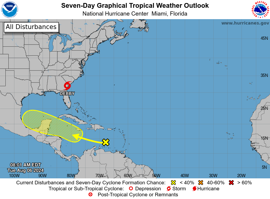
A tropical wave that began east of the Windward Islands over the weekend continues to produce showers and thunderstorms with little change in development, according to the latest National Hurricane Advisory.
As of Tuesday morning, the tropical disturbance was headed toward Mexico’s Yucatan Peninsula, the last place that Hurricane Beryl hit before striking Texas early last month.
“Any development of this system should be slow to occur during the next couple of days while it moves westward over the central Caribbean Sea,” the latest advisory states. “Environmental conditions are expected to become more conducive for development later this week as the system moves across the western Caribbean Sea or the southern Gulf of Mexico.
More: 5 record-breaking facts about Hurricane Beryl on its path to Texas
Track the disturbance
It is still unclear if the disturbance will develop into a tropical depression or tropical storm.
Formation chance through 48 hours: Low, 10 percentFormation chance through 7 days: Low, 30 percent

Hurricane storm tracker: See active storms in the Atlantic
Texas weather watches and warnings
What is a watch vs. warning?
A warning means that conditions are expected somewhere within the warning area.
A watch means that conditions are possible within the watch area. A watch is typically issued 48 hours before the anticipated first occurrence of tropical-storm-force winds, conditions that make outside preparations difficult or dangerous.
This article originally appeared on Austin American-Statesman: NHC tracking new tropical disturbance. See early path toward Texas
Source Agencies


