Autumn will kick off with better weather than delivered through most of summer with a ‘significant’ 30C sun blast to kick start the season.
After months of chilly winds, rain and largely grey skies, weather charts have suddenly turned a sizzling shade of scarlet.
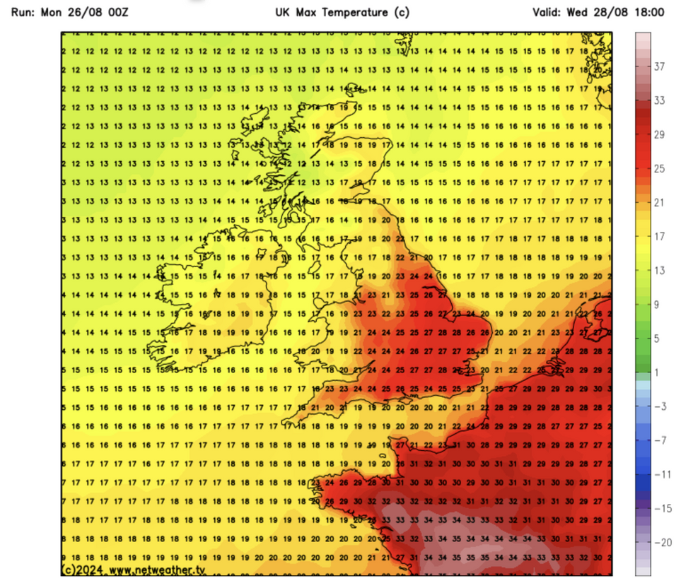
Thermometers later this week will rocket into the mid-20Cs, or even higher according to some experts.
A shift in weather patterns will allow high pressure to nudge the UK giving sun-starved Britons a joyous fillip lacking through summer.
James Madden, forecaster for Exacta Weather, said: “Weather models are showing some hot to extremely hot temperature developments through the start of September, with 30C or higher possible at the peak.
“There is now some quite high confidence in this coming off, with forecast projections repeating the same outcomes for this period.
“This is looking like a significant weather event for the UK.”
Britain’s summer so far has been blighted by a stubborn and angry jet stream ploughing chilly storm systems across the country.
The jet strengthened during the last stretch of summer to steer Storm Lilian’s 70mph winds across the UK last week.
LATEST DEVELOPMENTS:

Temperatures expected to rocket into the high 20Cs
Netweather
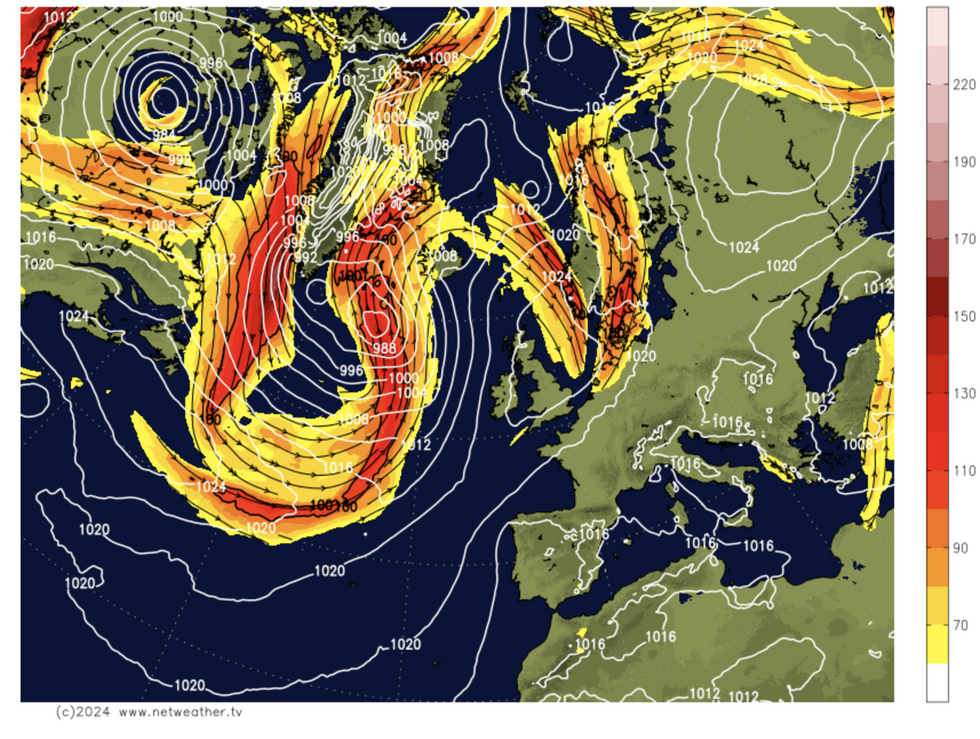
The jet, while still weaving and bobbing closer to the country than is usual for summer will take a swerve northwards.
This will allow high pressure to build over parts of the country which will benefit from the last of the summer sun.
Southern and central Britain will enjoy the best of the weather with a more unsettled picture for parts of the north.
Jim Dale, meteorologist for British Weather Services and social commentator, said: “We are looking at a region of home-grown high pressure building over the UK, and this is going to bring some very pleasant weather to much of the country from the start of September.
“We are expecting to see temperatures in the high 20Cs, particularly across the south, and while 30C is less likely, it is not out of the question.
“This is going to mean a very pleasant start to autumn for many, after what has been a pretty average summer overall.”
However, rapidly rising temperatures will at times bring the risk of thunderstorms, he warned.
He said: “With a rise in temperatures there will always be a risk of some atmospheric instability.
“So, there will be the risk of some thundery downpours through the start of next month.”
Southern Britain will see the best of the temperatures with Scotland and the north, closer to low pressure, feeling cooler.
Britain’s weather will feel drier and warmer through the next week before the mercury soars ahead of the weekend.

Map shows Jet stream shifting to the north
Netweather
Met Office meteorologist Annie Shuttleworth said: “[This] week is looking much drier and more settled.
“The most likely pressure pattern for Tuesday is low pressure to the north and west and high pressure over Scandinavia and across a lot of Europe, and that is going to bring more settled weather to eastern and central areas of the UK.
“Low pressure will bump into this higher pressure and be stopped where they are.”
Source Agencies


