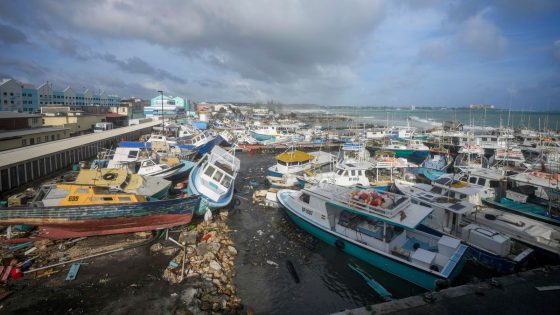
Hurricane Beryl has battered islands in the eastern Caribbean – killing at least seven people – and is now barrelling towards Jamaica.
Almost every home has been destroyed or badly damaged on Union Island in the Grenadines, where officials say the storm has caused “immense destruction”.
One local compared it to the destruction you would see in a movie – and said they wouldn’t even want their enemies to go through such devastation.
Beryl has weakened slightly but remains a powerful Category 4 storm – with Jamaica bracing for life-threatening winds and a storm surge. The prime minister there has urged everyone to treat it as a “serious threat”.
The National Hurricane Centre (NHC) in the US says it is “most concerned” about Jamaica, as Beryl’s core is expected to pass “near or over the island” in the coming hours.
Forecasters say this storm is unusual and has broken records. This is why.
How powerful is Hurricane Beryl?
No storm has reached Beryl’s level of intensity so early in the hurricane season, which runs from 1 June to 30 November.
Beryl leapt from a Category 1 to a Category 4 storm in under 10 hours, according to meteorologists.
This is the fastest intensification ever recorded before September.
But that’s not all. Beryl is the first Category 4 storm to ever form in the Atlantic in the month of June – and was also the earliest hurricane to develop into a Category 5.
Beryl had maximum sustained winds of 155mph at 5pm local time (10pm UK time) on Tuesday.
The NHC estimates it is moving west-northwest at 22mph, and will hit Jamaica at 2pm local time (7pm UK time) on Wednesday.
Officials have warned people in flood-prone areas to prepare for evacuation.
Beryl will still be near major hurricane strength when it reaches Jamaica, as well as when it arrives at Mexico’s Yucatan Peninsula and Belize late on Thursday, the NHC said.
Its course and power over the western Gulf of Mexico at the weekend are currently uncertain.
Before-and-after pictures taken by Maxar Technologies show Beryl’s impact on the Caribbean island of Carriacou in Grenada.
Climate change leads to warmer oceans
Warmer oceans are likely to be behind the unusually early formation and rapid intensification of the storm.
The water in the Atlantic is “hotter than it would normally be at the peak of the season,” Brian McNoldy, a tropical researcher at the University of Miami, told Sky’s science correspondent Thomas Moore.
Sea temperatures along the hurricane’s track are 2-3C warmer than normal.
“It’s pretty amazing. In terms of sea surface temperature, it’s warmer than it ever gets during the peak of the season,” said Mr McNoldy.
“In terms of ocean heat content, it looks like the peak of hurricane season – the second week of September. It’s pretty astounding.”
Global warming has helped push temperatures in the North Atlantic to record highs, added Christopher Rozoff, an atmospheric scientist at the US National Centre for Atmospheric Research.
He said warmer waters lead to more evaporation, which fuels more intense hurricanes featuring higher wind speeds.
Climate change’s likely contribution to the early formation and intensification of Hurricane Beryl could be an alarming preview of future storms.
The National Oceanic and Atmospheric Administration predicted in May that the 2024 hurricane season would be well above average, with between 17 and 25 named storms.
It suggested there would be as many as 13 hurricanes and four major hurricanes.
An average Atlantic hurricane season typically produces 14 named storms – seven of them hurricanes – and three major hurricanes.
Source Agencies


