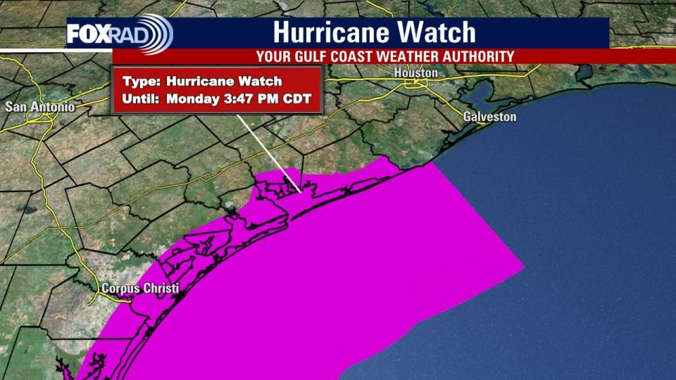
Texas – As all eyes in Texas are on Tropical Storm Beryl in the Gulf, the National Hurricane Center has issued a Hurricane Watch for the Texas area.
On Friday at 4 p.m., the watch was issued for the Texas Coast from the mouth of the Rio Grande to Sargent, Texas, which is located in Matagorda County. A Storm Surge Watch is also in effect for the same area.
SUGGESTED: Tropical Storm Beryl tracker: Latest update on path, Mexico landfall, Texas impacts

A Hurricane Watch means hurricane conditions are possible within the watch area. A watch is typically issued 48 hours before the anticipated first occurrence of tropical storm-force winds, conditions that make outside preparations difficult or dangerous.
How will Beryl impact Texas and Houston?
The models have been shifting just slightly northward toward Texas with the path of what will either be a Tropical Storm or Hurricane Beryl.
As of this moment, it does not look like a monster storm, but will certainly bring the threat of gusty winds, coastal flooding, and heavy rain from late Sunday through Monday and possibly Tuesday.
DOWNLOAD THE FOX 26 HOUSTON WEATHER APP BY CLICKING HERE
One bit of good news is that, for now, the storm is relatively small, so if its wind field remains on the small side, the wind and coastal impacts will be less severe.
Monday and Tuesday will bring the risk of heavy rain to much of Texas, including the Houston area. We don’t know for sure where a heavy rain band might set up, but the risk is there, so keep that in mind for early next week.
Source Agencies


