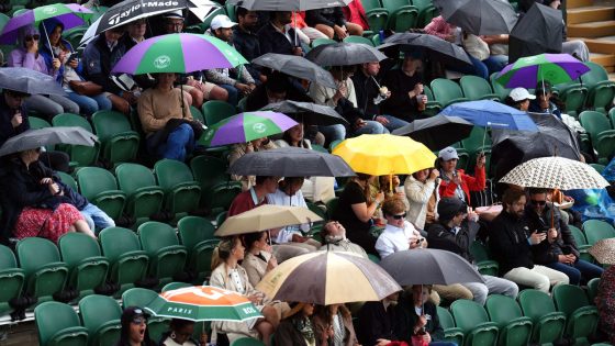
For most, the summer weather so far has been disappointing, often feeling like autumn.
Wimbledon has blamed the “terrible” weather for low attendance figures and outdoor attractions and tourism destinations have been left counting the cost.
It’s all down to the jet stream, a ribbon of air high up in the atmosphere, which has been either across the UK or further south.
It has allowed areas of low pressure to move in, bringing spells of wind and rain, while often leaving a cool northerly flow.
The next few days look no different, with more rain in the forecast, leading the Met Office to issue weather warnings for parts of the UK.
A band of rain will move northwards from Monday to Wednesday, giving 10-20mm quite widely.
South Wales, southwest England and northeast Scotland will see more, with 20-40mm likely, but areas of high ground can expect greater amounts.
Around 70mm is possible on Dartmoor and Exmoor, with up to 90mm across the Grampians and northwest Highlands on Wednesday.
That rain comes after a soggy weekend for many, which led to disruptions at everything from big events, down to small local ones like school fetes.
In fact, we are only eight days into July and some parts of southern England have already seen rainfall amounts close to their July average.
Hertfordshire has recorded 45.9mm of rain, which is 89% of their July average.
Essex and Oxfordshire have seen 80% and 79% respectively.
Just like June, it’s been another cool start to the month, with mean temperatures so far running 2.4C below average for the UK.
Read more:
Wimbledon and Grand Prix face disruption
What’s the forecast for July?
That said, it only took one short spell of hot weather in June to mask the cool three weeks of that month, with average temperatures for June just 0.4C below average in the end.
The UK and northwest Europe may be stuck in cool and changeable conditions at the moment, but that can’t be said for other parts of the continent.
Central and southeast Europe have already seen early summer heatwaves, with temperatures on the rise this week too.
Daytime highs are likely to be in the mid to high 30s in Celsius, some 5-10 Celsius above average, with uncomfortable conditions at night too.
Heat warnings have been issued, with a rare red warning covering parts of Croatia and Serbia on Wednesday.
There are heatwaves across other parts of the globe too, including western areas of the USA.
On Sunday, Las Vegas saw its highest temperature on record, reaching a daytime high of 49C (120F).
That’s all down to an upper-level ridge sitting over the west of the USA, which will keep a blocked pattern, with sinking air helping to increase the pressure and temperature at the surface.
That will allow the ongoing extreme heat in the area to continue this week, with further records likely to be broken as temperatures reach the high 40s and possibly low 50s in Celsius for parts of inland California.
Japan is another place experiencing high temperatures, with the country reaching 40C for the first time this summer on Sunday.
Back to the UK, if we look further ahead in the forecast, a ridge of high pressure will help settle the weather down from Thursday.
That will make it feel a bit warmer, but temperatures won’t be that impressive for July, staying around average.
Then a return to something more unsettled is expected late in the weekend/early next week, especially to the northwest.
But as for the second half of July, there are encouraging signs of something drier and warmer for a time, but exact details are a little uncertain at this stage.
Looking back to recent Julys, 2023 was far from summery too, with often cool, dull, windy and wet conditions.
On the other hand, July 2022 was the UK’s seventh warmest since records began in 1884, with unprecedented heat around the middle of the month.
That brought the UK’s highest temperature on record, with 40.3C being reached at Coningsby in Lincolnshire.
Source Agencies


